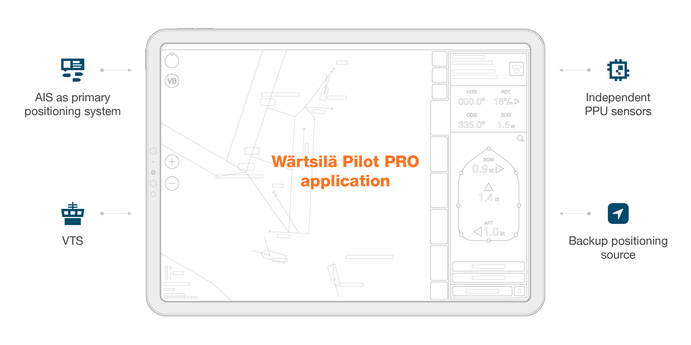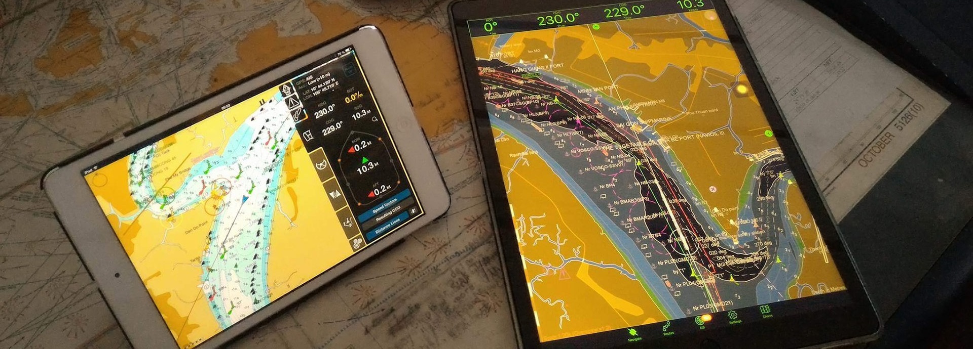
The Pilot PRO application has been developed specifically to meet the needs of pilot organisations and marine professionals. With a carefully considered range of support functions, the system is designed to assist pilots and navigation officers in their everyday activities. By bringing mobility and freedom on the bridge, it helps pilots to maintain efficient pilotage and other onboard operations. The app is fully customisable, as data can be integrated from different sources. To facilitate navigation under local pilotage conditions, Pilot PRO supports local navigational information, such as tidal currents, tidal reference points (high & low water, graphical diagram) and weather forecast data (wind, wave, air pressure, precipitation).

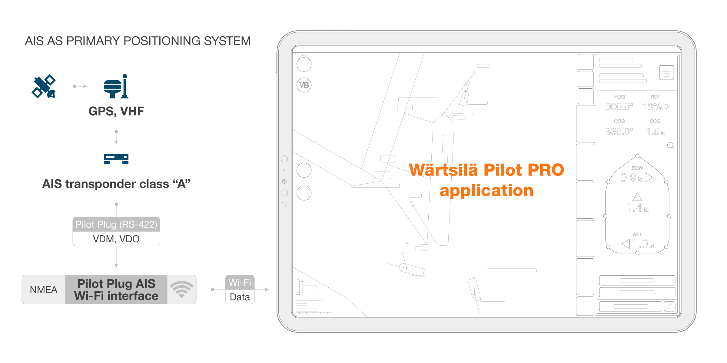
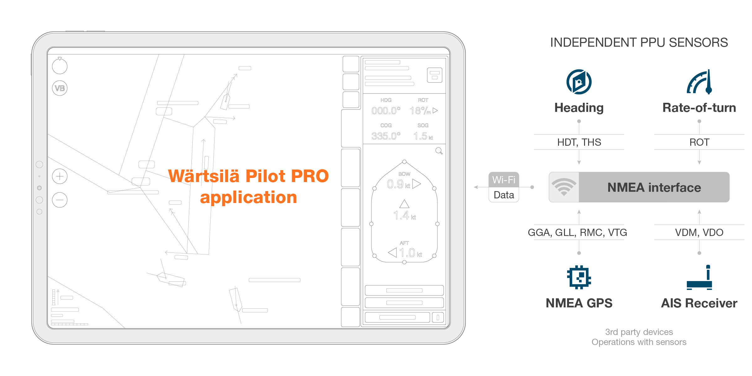
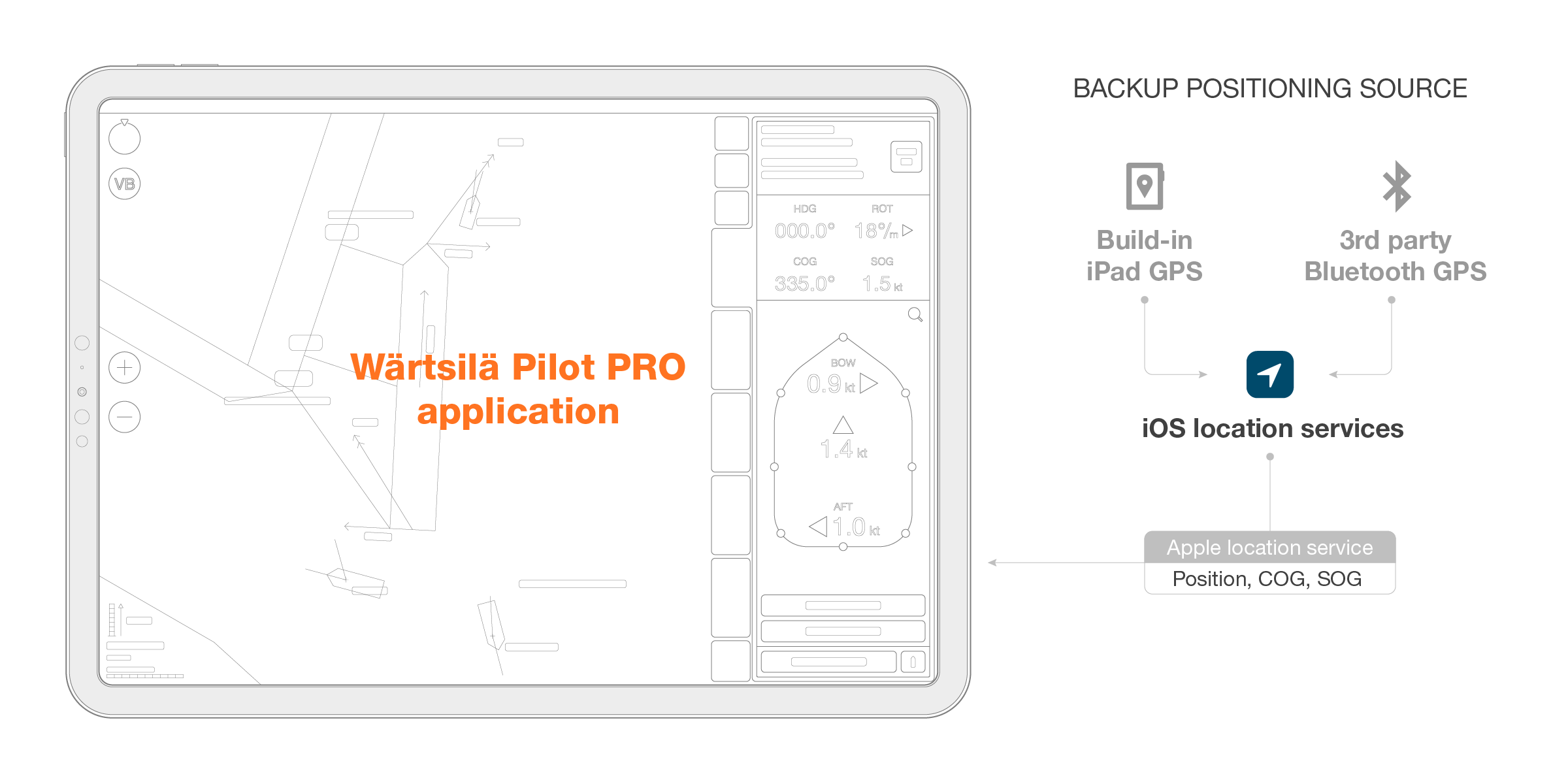
Pilot PRO supports a complete set of pilot sensors. The connection to external sensors can be performed via: